National geographic mapmaker interactive

With National Geographic MapMaker Interactive, students can explore the world with different map themes, data, and tools to customize your own map.
The homepage is displayed on the right, with the themes along the left side of the page.
There are also drawing tools and markers to customize your map.
Here are directions to make a geotour, a customized map that includes links. You can save then share your map, and even collaborate with others.
National Geographic. MapMaker Interactive. http://education.nationalgeographic.com/education/mapping/interactive-map/?ar_a=1. 2014.
Read!
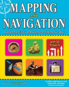
Brown, Cynthia. Mapping and Navigation: Explore the History and Science of Finding Your Way. White River Junction, VT: Nomad Press, 2013.
In this book, "students ages 9-12 will learn the history and science behind the evolution of mapmaking, and how much is still out there for discovery. Readers will explore ideas through hands-on-experiments while learning new terminology and interesting facts. Projects include using triangulation to measure distances, creating contour lines on a mini-mountain to understand elevation changes on a map, and inventing a sundial and compass to understand the basics of navigation. Whether mapping the solar system or mapping their own backyard, all readers will be able to understand mapping technologies and see the word in new and exciting ways."--Publisher's description.
Use this book along with the National Geographic MapMaker Interactive to complete the projects!

Jacobson, Cliff. Basic Illustrated: Map and Compass. Guildford, CT: Falcon Guides, 2008.
Wilderness guide Cliff Jacobson created the map and compass curriculum for the Minnesota Department of Natural Resources, and here he shows easy-to-follow steps on choosing a compass, reading contour lines and other map features, using them in concert with a GPS receiver, plotting a course in the wilderness, navigating at night by the stars, and much more (From the publisher).
Use this book to try out some map skills!

Stevenson, Robert Lewis, Wim Coleman, and Pat Perrin. Treasure Island. North Mankato, MN: Capstone, 2007.
In graphic novel format, young Jim Hawkins discovers an old treasure map and sets out on a harrowing voyage to a faraway island. The violent sea is just the first of many obstacles, as Jim soon learns there are dangerous men seeking the same treasure (from the publisher).
Read this graphic novel of Treasure Island about a boy who finds a treasure map!
